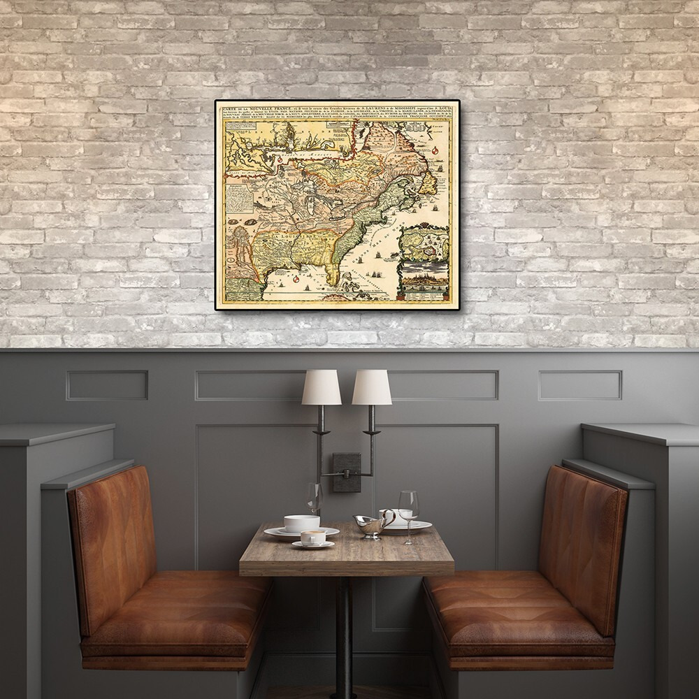
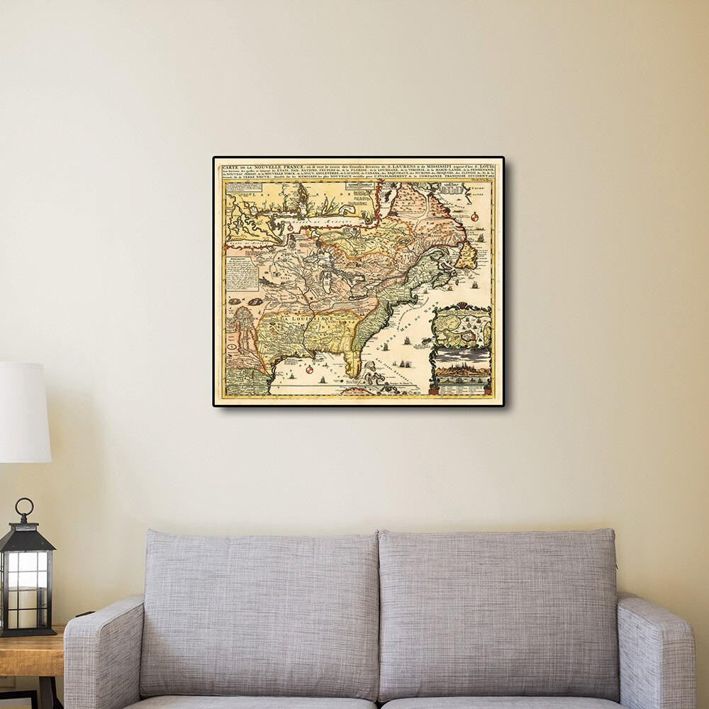
Carte De La Nouvelle France Translated Map Of New France Originally Published In 1718 Is A Classic Reproduction Vintage Map By Henri Chatelain. This Print Shows The Inhabited Parts Of North America As Of The Early 1700S. This Map Based On The 1699 Voyage Of Pierre Le Moyne D'Iberville. An Inset In The Top Left Features The Mississippi Delta And Mobile Bay. The Inset In The Lower Right Includes A Plan And View Of Quebec Canada. Vignettes And Notes Throughout The Map Highlights Many Points Of Interest. Printed On Heavyweight Matte Art Paper This Vintage Looking Historic Map Poster Is Ready To Frame Mount Or Display As A Poster Directly On The Wall.
Actual product packaging and materials may contain more and/or different information than that shown on our website. We recommend that you do not solely rely on the information presented and that you always read labels, warnings, and directions before using or consuming a product.
For additional information about a product, please contact the manufacturer. Content on this site is for reference purposes and is not intended to substitute for advice given by a physician, pharmacist, or other licensed health-care professional. ZiFiti does not assume liability for inaccuracies or misstatements about products.
Statements regarding dietary supplements have not been evaluated by the FDA and are not intended to diagnose, treat, cure, or prevent any disease or health condition.


 Red")

 White And Silver")